At the beginning of this process I spoke with Clare and ran through my proposal it’s changed a little as I expected it to in an organic way much as many projects do,well mine anyway. This is an outline of the first research I did my initial hopes and ambitions for the idea and where I see it heading.
I was looking for a photographic vehicle initially to explore issues such as migration,climate change,town planning,the politics and resultant social consequenses of these.In the present climate it’s interesting to relate these to a historical context and how we relate as humans to it. I chose a road and this one in particular because it offers opportunities to explore many if not all of these things and set them out with a common link visually and metaphorically.I’m keen to explore how the history of this road as effected and formed communities along side it, how it was formed out of economic neccesity.
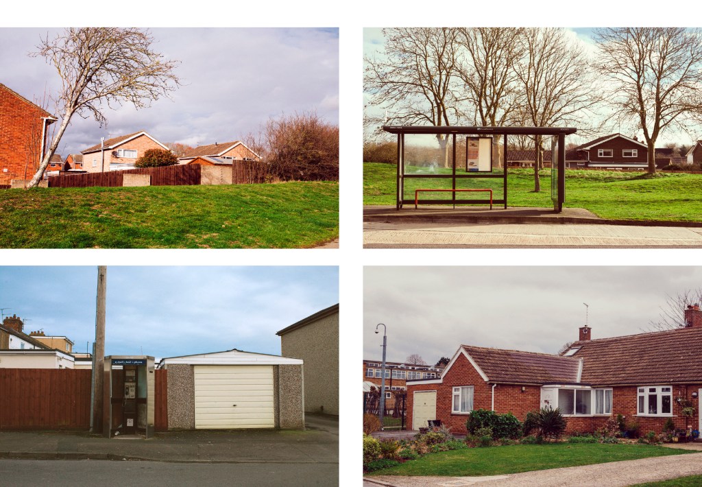
The rise in rents of the early twentieth century in traditional areas of manufacture closer to the city forced businesses to move to the outskirts coupled with the the advent of motor cars made the transport of goods and communications quicker and easier the expansion of the London really started to take shape.Quickly forming new communities often made up of migrating people both from existing communities (Jewish people for instance to Gants Hill) and more lately new communities seeking work from Eastern europe.
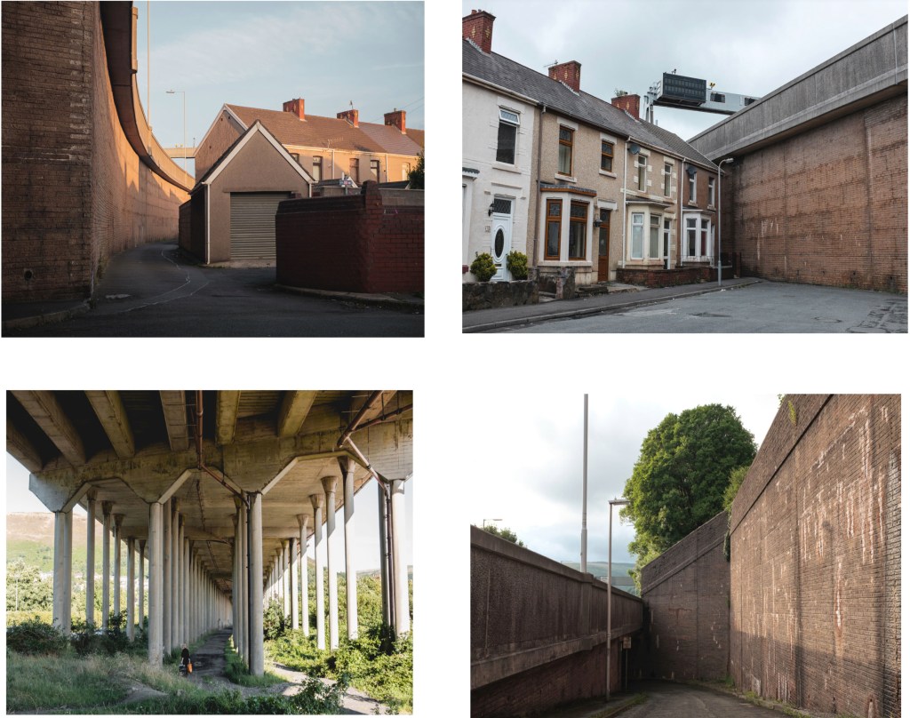
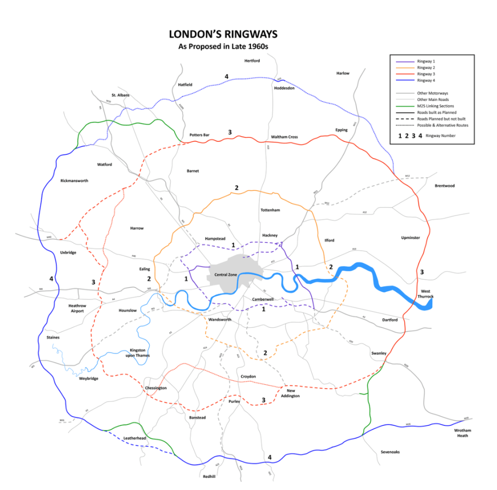
Originally conceived post WW1 it linked these business’s and protected other essential business’s safe during conflict,the road as grown organically linking these areas of business and community from the early 20th century expanding many times through to the present time.The most part being through the work of the town planners during the 1960s as part of the London Ringways scheme,much of which was abandoned but consisted of 4 ringroads one of which the Westaway is pretty much the only bit ever built to feed traffic and rail on a raised road above the central part of the city thus rendering the streets below practically car less, a second road a bit further out that was to follow what is now the North London Rail line through Camden/Kings x. The North Circular was and I suppose is ring road 3 along with the South circular and the M25 conceived in the 1960s and finished in the 1980s is Ring way number 4.
I’m interested like the Thames in the past how these roads have helped form new communities and how the old ones have faired,how like the tributaries of the Thames roads or new tributaries have formed and formed new settlements and old ones been buried and are long gone like those of the old Docklands out by the City Airport a good example of dystopian town planning if ever there was with it’s ghost pubs once awash with people.Coincidently home to one of the best new parks in London,the Thames Barrier park is fantastic on a summers day,if you can get over the smell of the old Beckton Gas works.
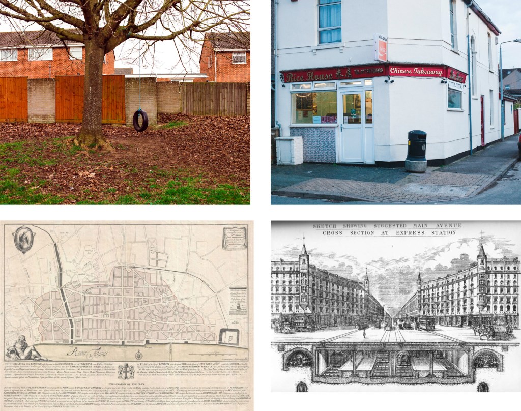
I’m keen to understand more about the places of entertainment for example the illegal raves under the flyovers,the banqueting halls,Crazy Golf and Easy hotels placed right by the busiest most polluted road in England.There are burial grounds and Cafes for bikers,which I can understand,it’s origins being before the big road came through,i’m sure it would have some stories to tell.
Then there is the migration,not only the legal natural migration but also teh many tent cities built by the groups of homeless migrant workers under flyovers and waste ground allowing them easy access to the many Wickes stores where they sell their labour by the day much like the dockers and seamen of the Old Thames.
The theory I have heard is they set up around these hostile places because less people pass through such unpleasant places and so are less vulnerable to unwanted attention and attacks.
And what of the future,it looks quite rosy with new estates of housing being built,cross rail stations nearby,legal places to rave ! Using up the brownfield sites laid in waste as flytippers paradises for decades whilst succesive town planners and governments decide what to do with them.The houses compulsary purchased for road widening in the 1980s that have also laid waste gathering dust have been renovated and given a new lease of life. I wonder how the people forcibly moved out all that time ago think about that now.
I hope as part of this project to speak to some of these people and many more and record a oral history to show along side the images.
Along side this multi media exhibition I envisage a book and have Hoxton Mini Press in mind to published based on the local interest subject matter and the publishing model they use.I’m keen to get localised interest through workshops and exhibitions,visits to school and local organisations. Radio interest via Robert Elms London radio show,something I have used before for previous projects.I’d like to work alongside organisations such as RIBA who I am aware exhibit and hope to interest in this body of work.
Here are some of the influences and references I have used to inform the project.As I go on I will be referring back to them and others as I progress and write about the project.
David Campany Open Road
Go Home Polish
http://www.michaliwanowski.com/go-home-polish/4594130098
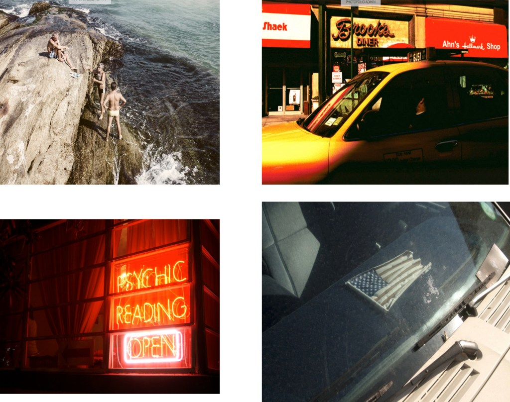
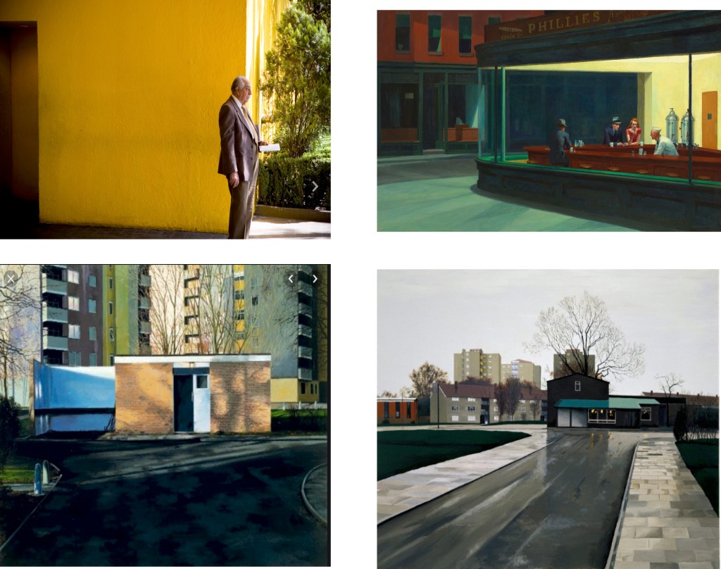
Stephen Shore,Robert Frank,Robert Rauschenberg,Ed Ruscha,Hopper,George Shaw
Nick St Oegger PTbypassed Port Talbot and the effect of the M4
https://www.enfieldindependent.co.uk/news/4672139.a406-timeline-a-half-century-of-broken-promis-
es/#gallery1 https://en.wikipedia.org/wiki/North_Circular_Road https://en.wikipedia.org/wiki/London_Ringways
https://www.blurb.co.uk/books/5355783-a-closer-look-at-the-a406 https://www.roads.org.uk/ringways https://www.roads.org.uk/motorway/a406
https://www.sabre-roads.org.uk/forum/viewtopic.php?t=16424