
Similar to the River Thames in London,the Danube in Budapest,The Seine in Paris (I’m sure there are many more examples) roads such as the A406 divide cities and communities,unlike the rivers civilisations and communities choose to situate on the banks for many reasons,with roads in established cities like London it can be the other way around and displace and cut through already existing communities,creating a physical and mental barrier between once co existing neighbours again with the physical barriers and also with opinions on the wider topic.Take for instance the anti road buildings protests prominent in the 1980s and 1990s where opinions on such projects as the M11 link road split opinion down the middle.The extension had been proposed as part of the aforementioned London Ringways project as far back as the 1960s.The protest centred on environmental issues around pollution as well as the compulsory purchase of a row of houses in Claremont St Leyton squatted in by artists and activists and the destruction of an ancient Oak tree on George Green.The latter creating awareness to the cause and much more grass roots support to what was already a very well supported protest.Many of the protesters went on to form Reclaim the Streets an environmentalist campaign group who focus their work on reducing pollution via opposition to building on public open spaces via the spread of globalisation ,the origins of Extinction Rebellion can traced back to this period of road protests with prominent campaigner Daniel (Swampy) Hooper having taken part in both The Newbury By-Pass protests in the mid 1990’s,many more in between and as late as September 2019 when he tied himself to a concrete at the entrance of Valero Energy fuel refinery in Wales.
The South Woodford to Barking relief road opened in 1987 is one of the last sections to be built,cutting through the community like the Berlin wall however unlike Berlin the houses and streets were demolished by the town planners and not the Royal Air Force as it was in 1945.Up until then the road avoided Epping Forest and directed traffic right at the Water Works roundabout through Whipps Cross towards the Woolwich Ferry the Relief Road now carves deep into the ground (built using concrete piling then digging out the earth in the middle) stopping short of the Ferry by a few miles.On one side now where once stood the halls of residence for Queen Marys University students there now stands luxury flats built on false promises of a local swimming pool being built and a provision for affordable housing.However in this case the flats failed to sell to the young professional’s intended and are now quite rightly rented via housing associations and the local council to those in need including those with families which whilst solving one problem generated by gentrification creates others with no thought given to extra school places and GP surgeries.When done correctly gentrification or as I like to call it improvements and maintenance can be a good thing.
On the other side (South) we have the remains of Grove Hill and further West on the other side (North) where the other side of Grove Road would be is where the existing road is now with the roads running adjacent to them all wiped out by the road.
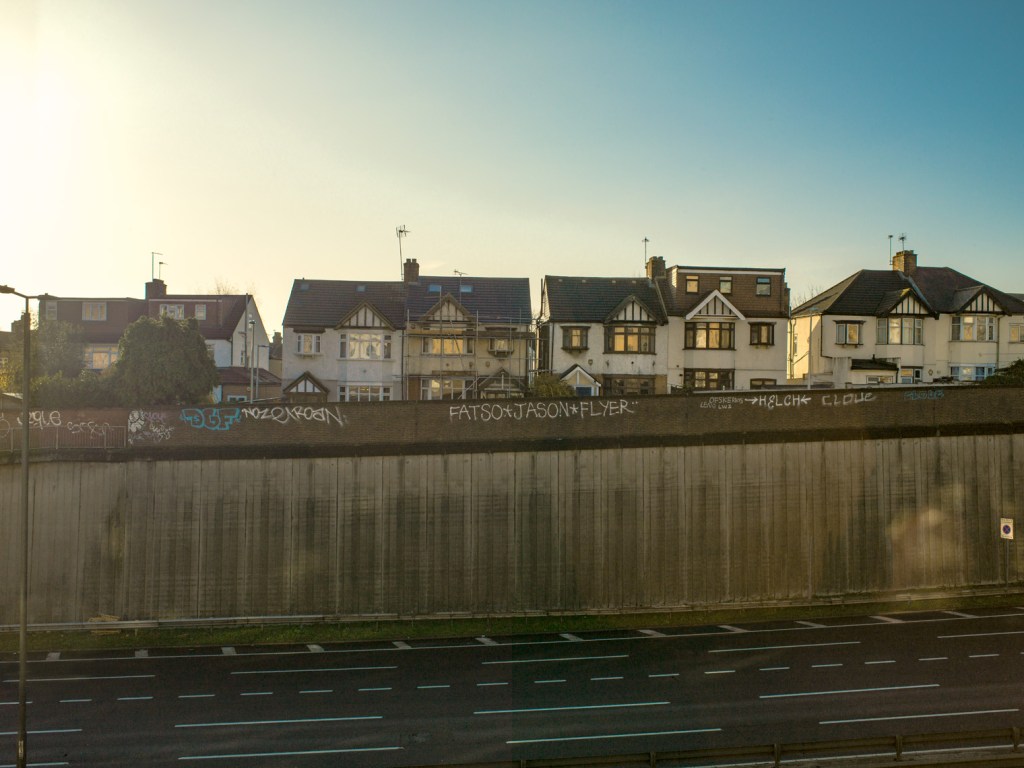
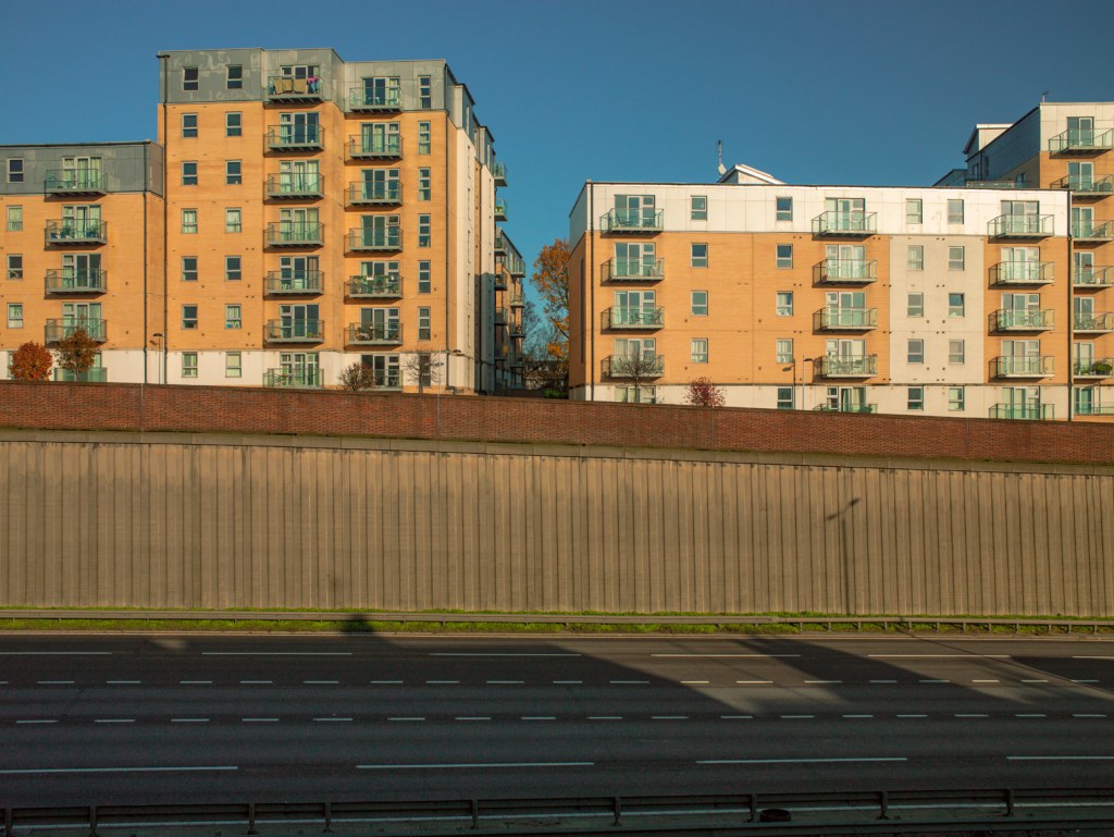
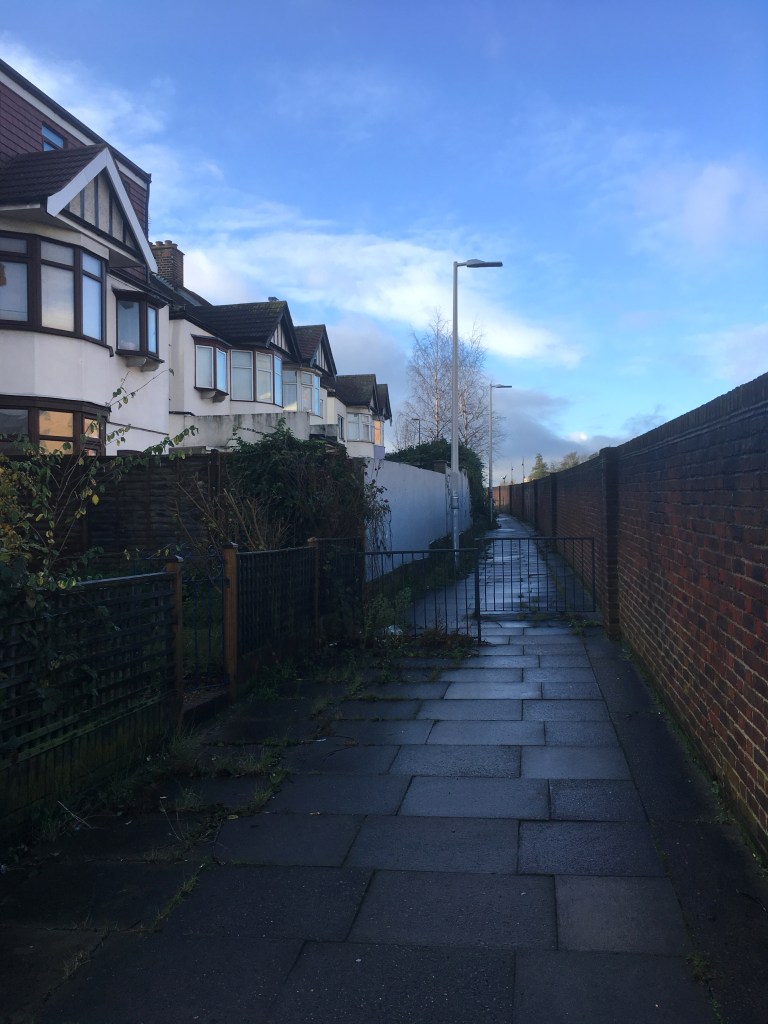
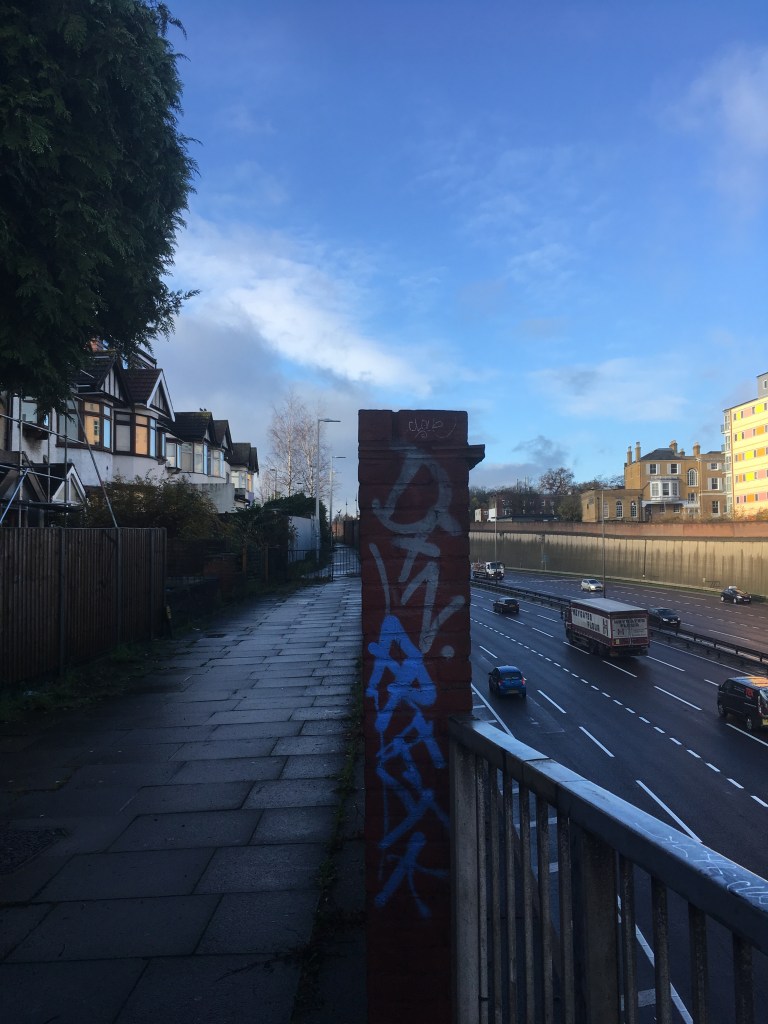
On both sides of the road are large deep concrete walls with the road laid low to avoid noise and pollution hitting the surrounding areas,like the pollution the low hum still permeates,I wonder who sits on the balconies of these lovely apartments overlooking the road,checking out the 6pm rush hour.I think I might. However they are the lucky ones as the houses on the other side of the street have only 8 foot wall to look at only 5 feet from what would have been their front gate.All the houses would have faced the terrace opposite but now it seems whilst the structure to most remains the same the back door as become the front ! The examples below I think show it well. I have included an example of the street from a different angle just for explanation .I intend to show the other two (sides of the street) images as a pair.Grove Hill reminds me of the road side hoardings Walker Evans image House,Atlanta,Georgia (1936) from the book/exhibition American Photographs which also shows “a brutal barrier built to shield houses from pollution and noise of an expanded road.The porches of the well appointed homes now look onto nothing,while the view from the upper balconies is a charmless strip ” (David Campany, Open Road) ,David goes on to say how the movie posters are not for the occupants but for the motorists passing through.Much like the graffiti adorning the wall opposite the flats outside the houses on Grove Hill.
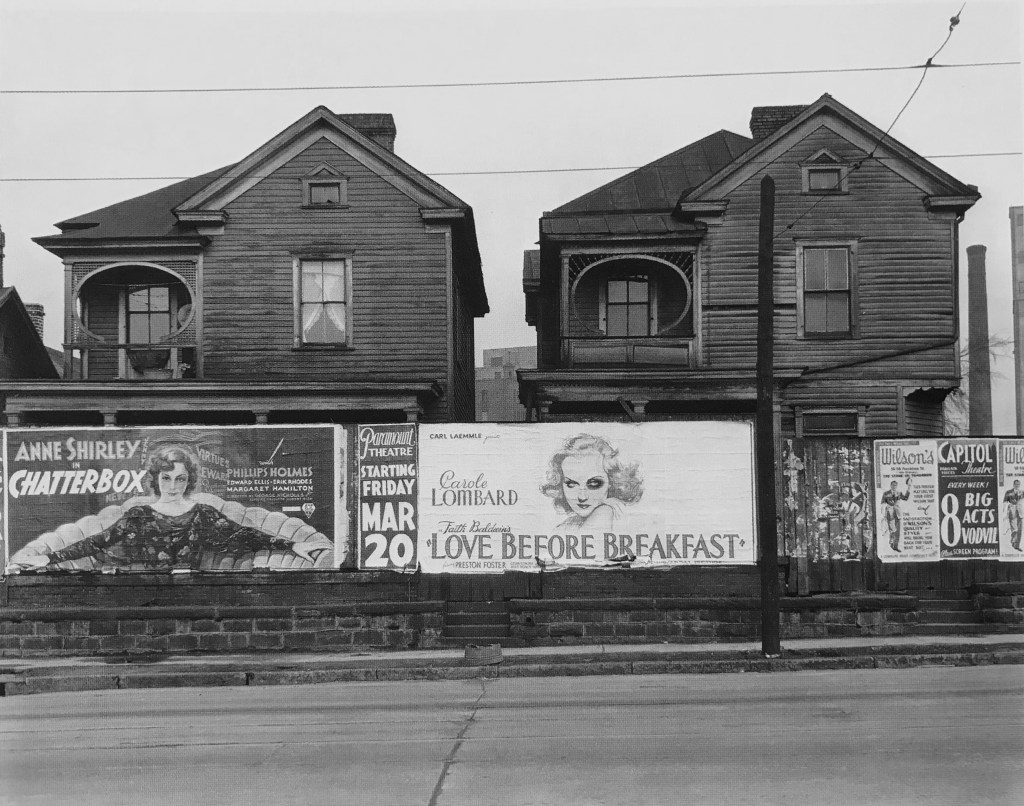
Walker Evans Houses,Atlanta Georgia (1936) Detail.
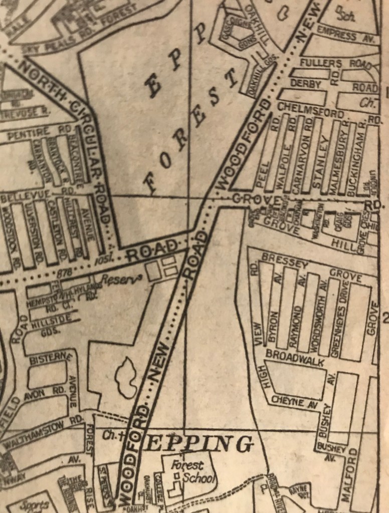
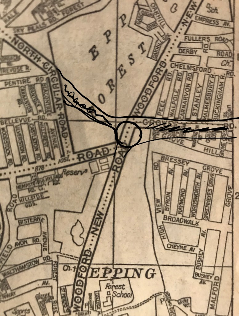
Road map of the area before and a rough approximation of the relief road taken from an A-Z of London date unknown a bit dog eared (bottom right)
