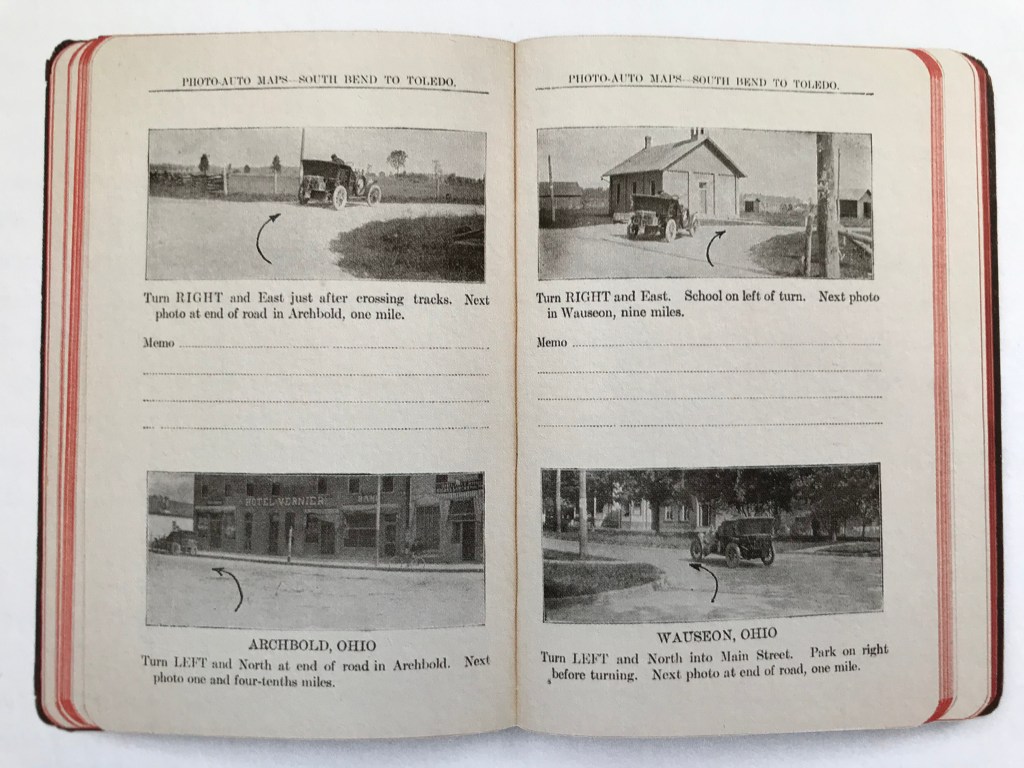
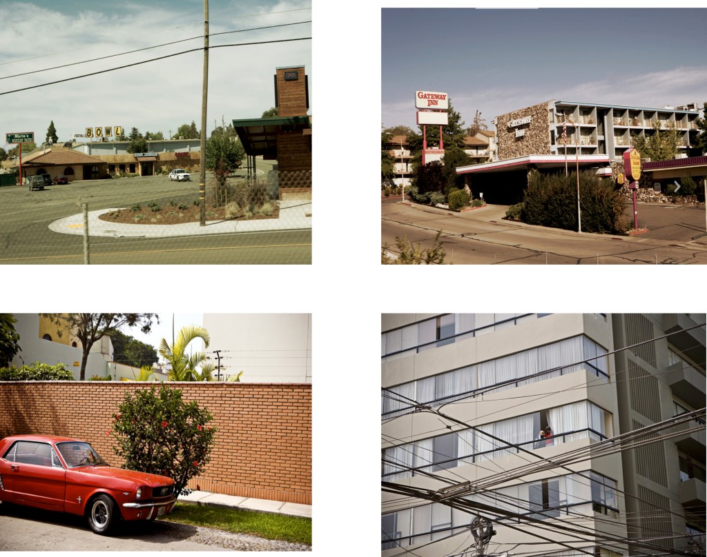
Before Google maps,A to Z’s and AA road maps, even before there were many roads and certainly before any signage and road names the new found car owners could use the Rand McNally Photo-Auto guide launched in 1906 to guide them. Essentially a series of photographs taken from the point of view of the driver with added text describing landmarks and juncture at which to turn left,right or straight on it could easily be described as a precursor to Google Street View and early use of the camera as a tool to aid motoring.Not unlike Google maps/street view it also suffered with the lack of updates only in the case of the Rand Mcnally these changes were far to rapid for it to ever catch up and so became redundant very quickly. Like Google Street View though these books have become a kind of work of art of their own.
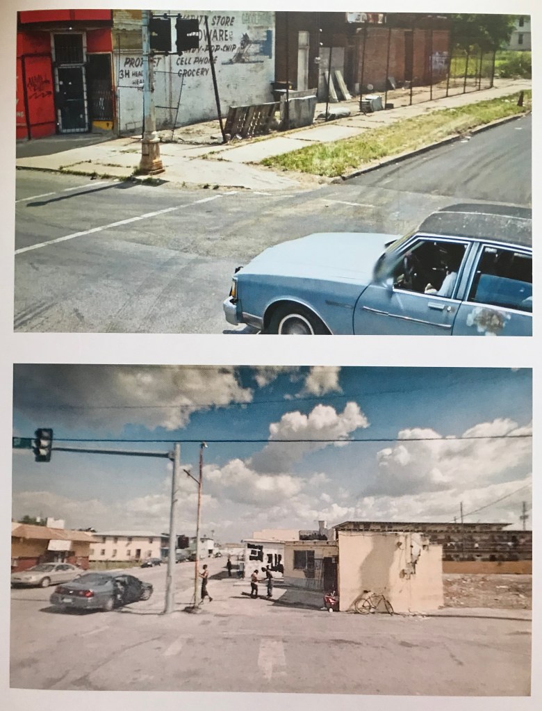
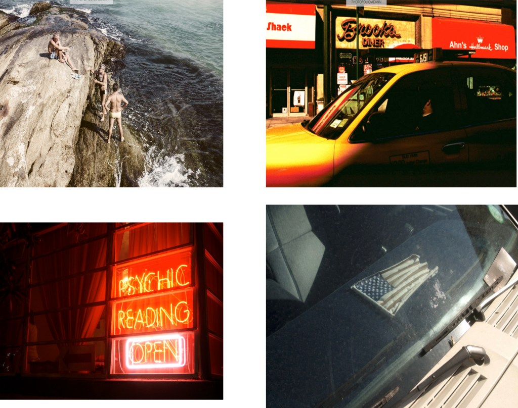
In the case of Google many artists have used it within their work.One such contemporary artist is Doug Rickard who scours Google Street Map looking for unusual scenes and scenarios often taking place at junctions,much the way many artists in the past might have done in the “real” world from the windows of moving cars .
Rickard makes good use of Google’s image library to virtually explore the roads of America looking for forgotten, economically devastated, and abandoned places. After locating and composing these scenes of urban and rural decay, Rickard re-photographed the images on the computer screen with 35mm camera then represents them as part of a new form of document
The low-resolution images that Rickard favours have a dissolved, painterly effect, and sometimes have people in them,some of whom are aware of the camera but are of course anonymous and blurred,adding another layer of almost surrealistic isolation.
Rickard’s work knowingly references traditional American photographers such as Walker Evans, Robert Frank and Stephen Shore and whilst he acknowledges them he strives to move the tradition on using new technologies to document a world in which a camera mounted on a moving car can generate evidence of the people and places it is leaving behind. These images present a photographic portrait of the socially disenfranchised and economically powerless, those living an inversion of the American Dream, again exploring the outsiders,the peripheral.
Top: Pages from Rand Mcnally Photo-auto guide New York to Chicago circa 1906
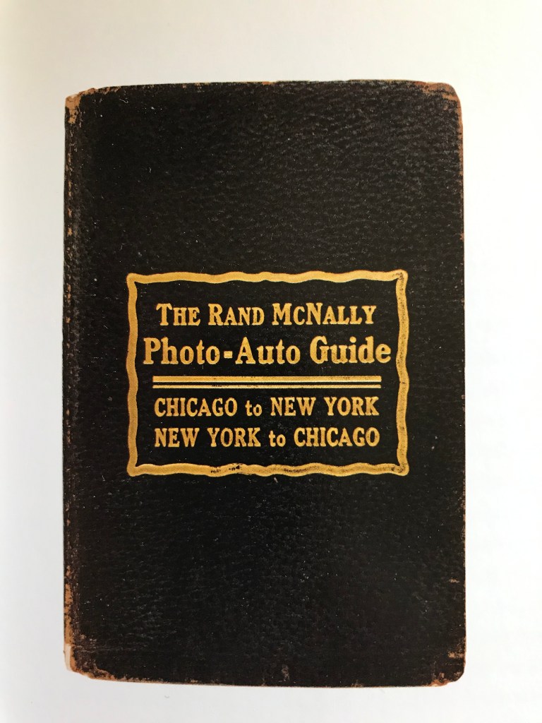
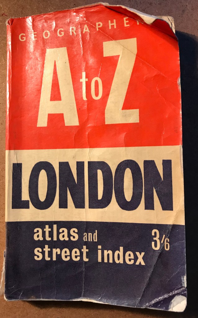
Middle: Front cover of Rand Mcnally Photo-auto guide New York to Chicago circa 1906
Bottom: Doug Rickard from A New American Picture published by White Press/Schaden in 2010
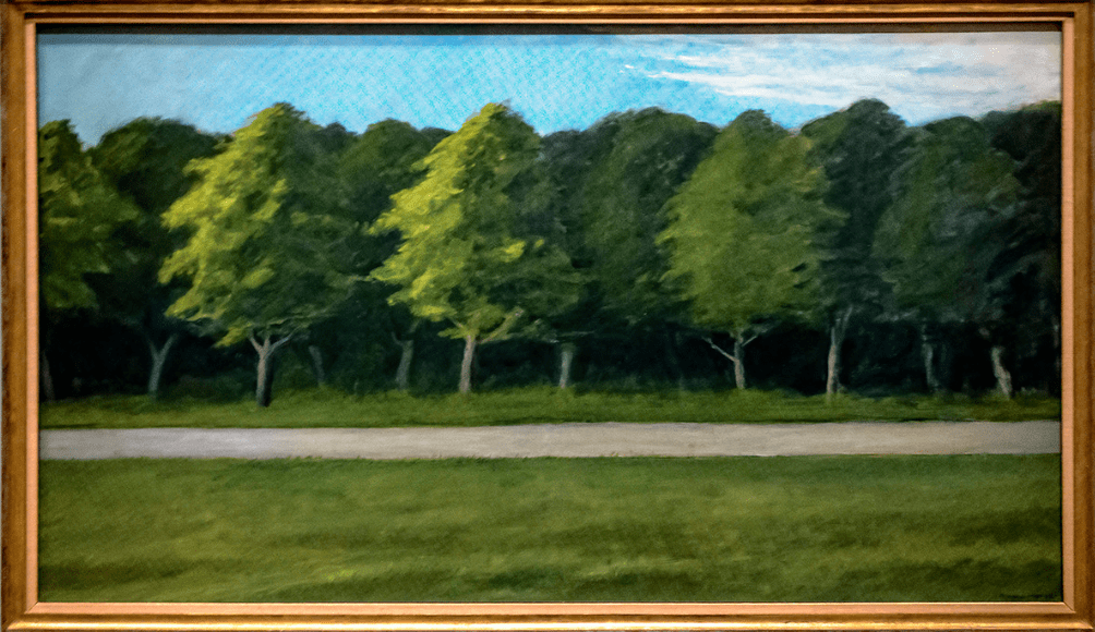
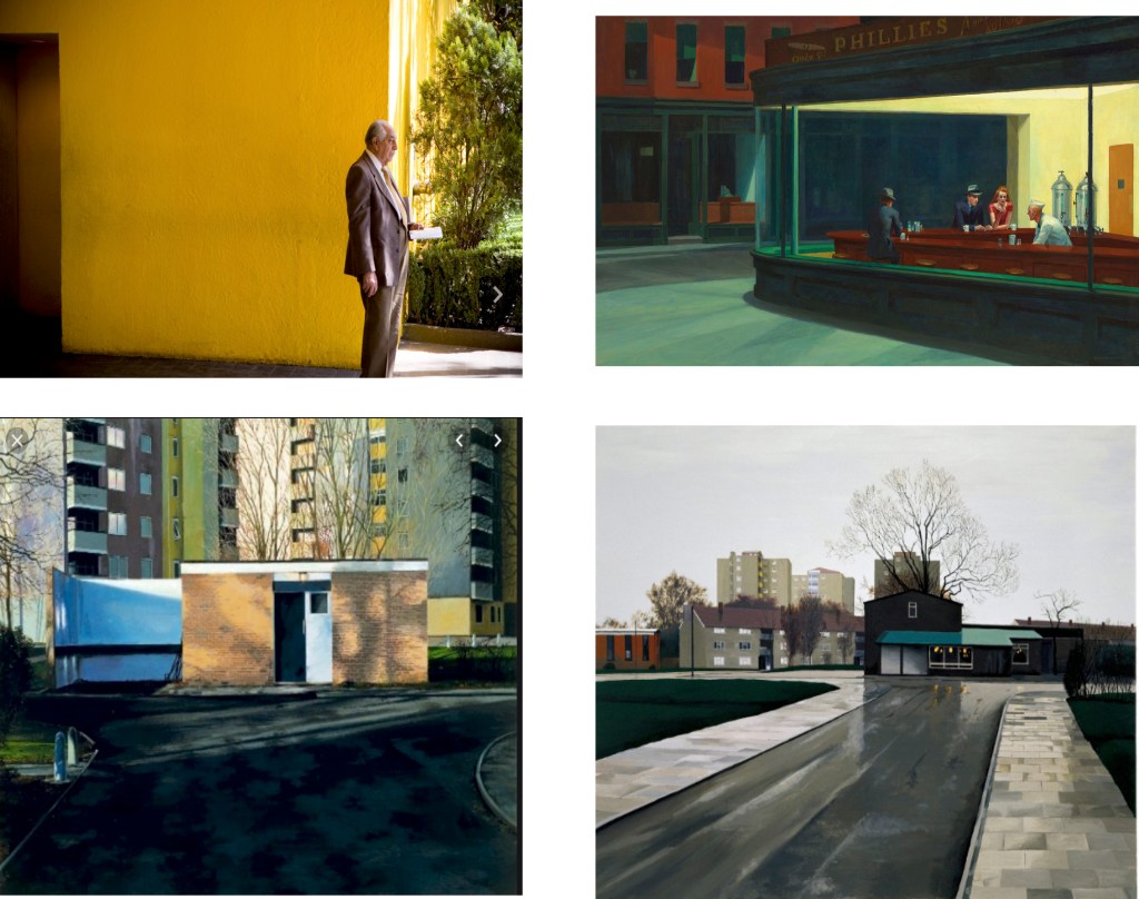
Like many I have been a big admirer of Edward Hoppers paintings ,but until recently I was not aware of the work he did in later life.For years his images included the iconography of the road such as petrol stations and diners.In 1962 he painted Roads and Trees,originally in test drawings he included a car but for the final image it was removed as was anything else felt unnecessary.Leaving a calm quietness to the image,there is a slight blurring to the trees creating the feeling of being on the move,a journey.I relate well to this and in all my images so far have endeavoured to pursue the calm and sense of journey all be it without the movement but certainly with out cars or traffic.No mean feat at any time of the day on the A406.
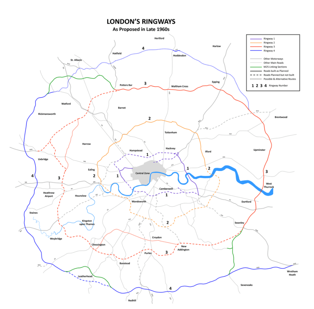
Similar to the River Thames in London,the Danube in Budapest,The Seine in Paris (I’m sure there are many more examples) roads such as the A406 divide cities and communities,unlike the rivers civilisations and communities choose to situate on the banks for many reasons,with roads in established cities like London it can be the other way around and displace and cut through already existing communities,creating a physical and mental barrier between once co existing neighbours again with the physical barriers and also with opinions on the wider topic.Take for instance the anti road buildings protests prominent in the 1980s and 1990s where opinions on such projects as the M11 link road split opinion down the middle.The extension had been proposed as part of the aforementioned London Ringways project as far back as the 1960s.The protest centred on environmental issues around pollution as well as the compulsory purchase of a row of houses in Claremont St Leyton squatted in by artists and activists and the destruction of an ancient Oak tree on George Green.The latter creating awareness to the cause and much more grass roots support to what was already a very well supported protest.Many of the protesters went on to form Reclaim the Streets an environmentalist campaign group who focus their work on reducing pollution via opposition to building on public open spaces via the spread of globalisation ,the origins of Extinction Rebellion can traced back to this period of road protests with prominent campaigner Daniel (Swampy) Hooper having taken part in both The Newbury By-Pass protests in the mid 1990’s,many more in between and as late as September 2019 when he tied himself to a concrete at the entrance of Valero Energy fuel refinery in Wales.
The South Woodford to Barking relief road opened in 1987 is one of the last sections to be built,cutting through the community like the Berlin wall however unlike Berlin the houses and streets were demolished by the town planners and not the Royal Air Force as it was in 1945.Up until then the road avoided Epping Forest and directed traffic right at the Water Works roundabout through Whipps Cross towards the Woolwich Ferry the Relief Road now carves deep into the ground (built using concrete piling then digging out the earth in the middle) stopping short of the Ferry by a few miles.On one side now where once stood the halls of residence for Queen Marys University students there now stands luxury flats built on false promises of a local swimming pool being built and a provision for affordable housing.However in this case the flats failed to sell to the young professional’s intended and are now quite rightly rented via housing associations and the local council to those in need including those with families which whilst solving one problem generated by gentrification creates others with no thought given to extra school places and GP surgeries.When done correctly gentrification or as I like to call it improvements and maintenance can be a good thing.
On the other side (South) we have the remains of Grove Hill and further West on the other side (North) where the other side of Grove Road would be is where the existing road is now with the roads running adjacent to them all wiped out by the road.
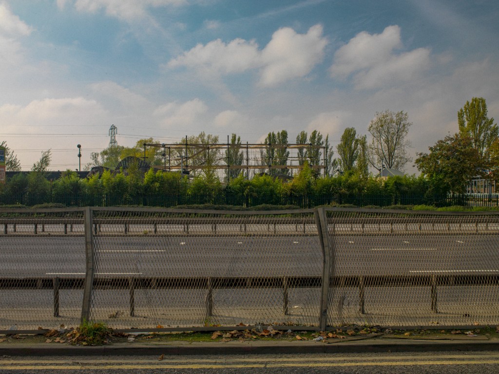
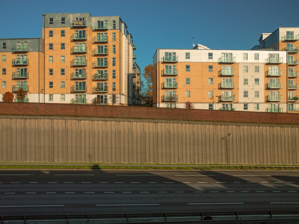
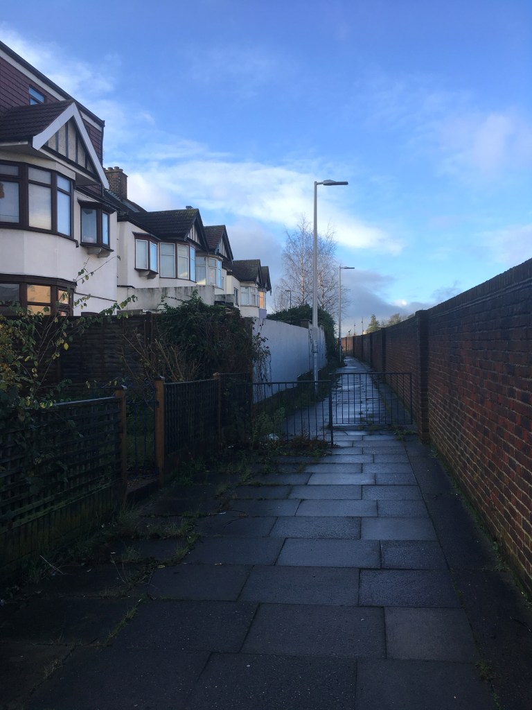
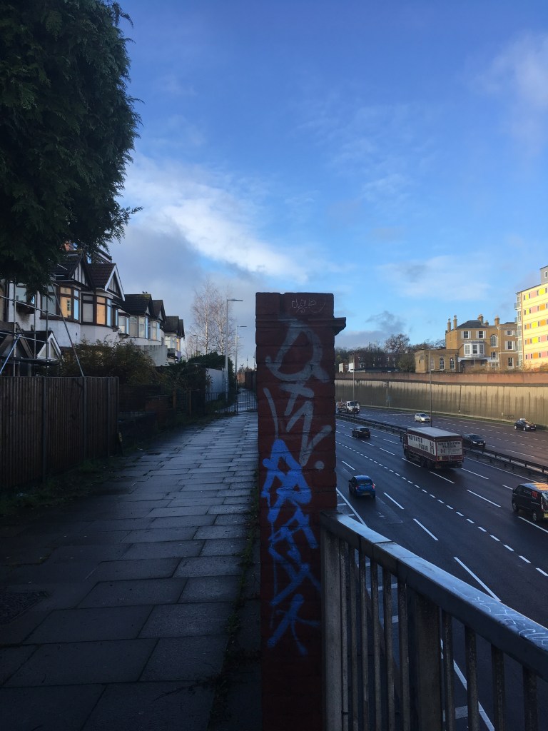
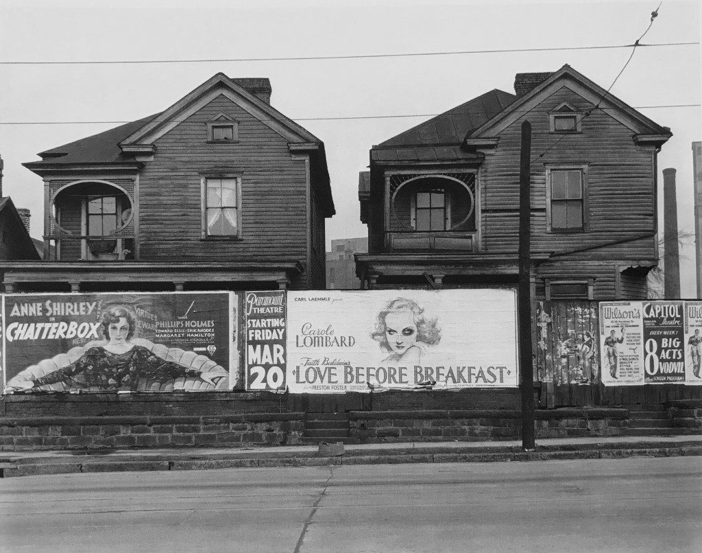
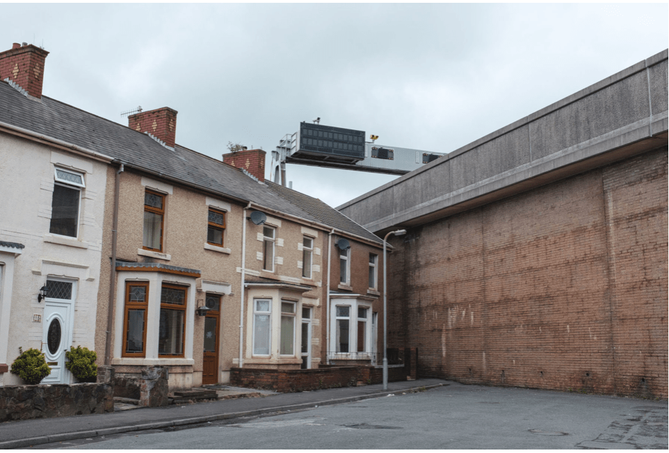
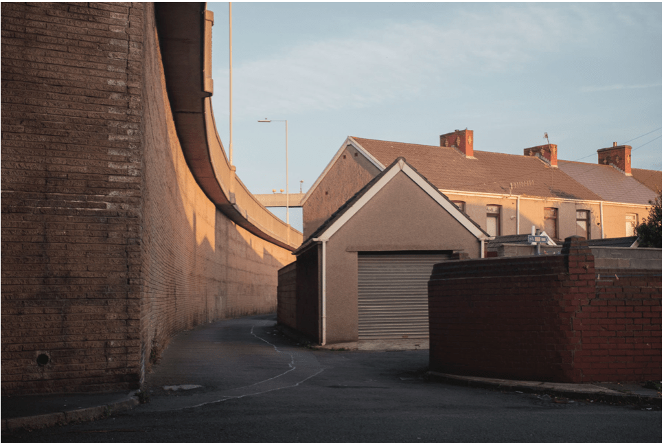
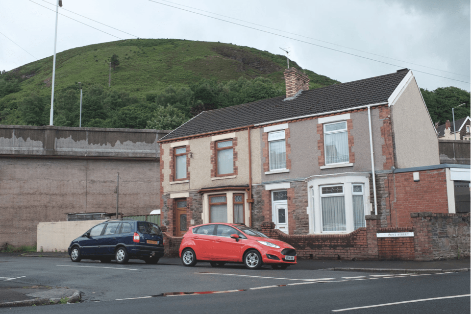
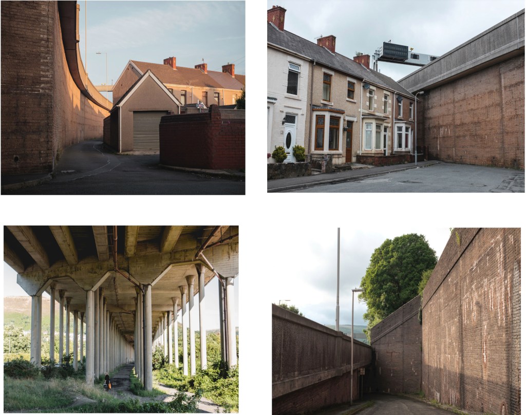
On both sides of the road are large deep concrete walls with the road laid low to avoid noise and pollution hitting the surrounding areas,like the pollution the low hum still permeates,I wonder who sits on the balconies of these lovely apartments overlooking the road,checking out the 6pm rush hour.I think I might. However they are the lucky ones as the houses on the other side of the street have only 8 foot wall to look at only 5 feet from what would have been their front gate.All the houses would have faced the terrace opposite but now it seems whilst the structure to most remains the same the back door as become the front ! The examples below I think show it well. I have included an example of the street from a different angle just for explanation .I intend to show the other two (sides of the street) images as a pair.Grove Hill reminds me of the road side hoardings Walker Evans image House,Atlanta,Georgia (1936) from the book/exhibition American Photographs which also shows “a brutal barrier built to shield houses from pollution and noise of an expanded road.The porches of the well appointed homes now look onto nothing,while the view from the upper balconies is a charmless strip ” (David Campany, Open Road) ,David goes on to say how the movie posters are not for the occupants but for the motorists passing through.Much like the graffiti adorning the wall opposite the flats outside the houses on Grove Hill.
Fatso,Grove Hill A406 and Fancy flats overlooking A406, A406 .Both by Dean Belcher
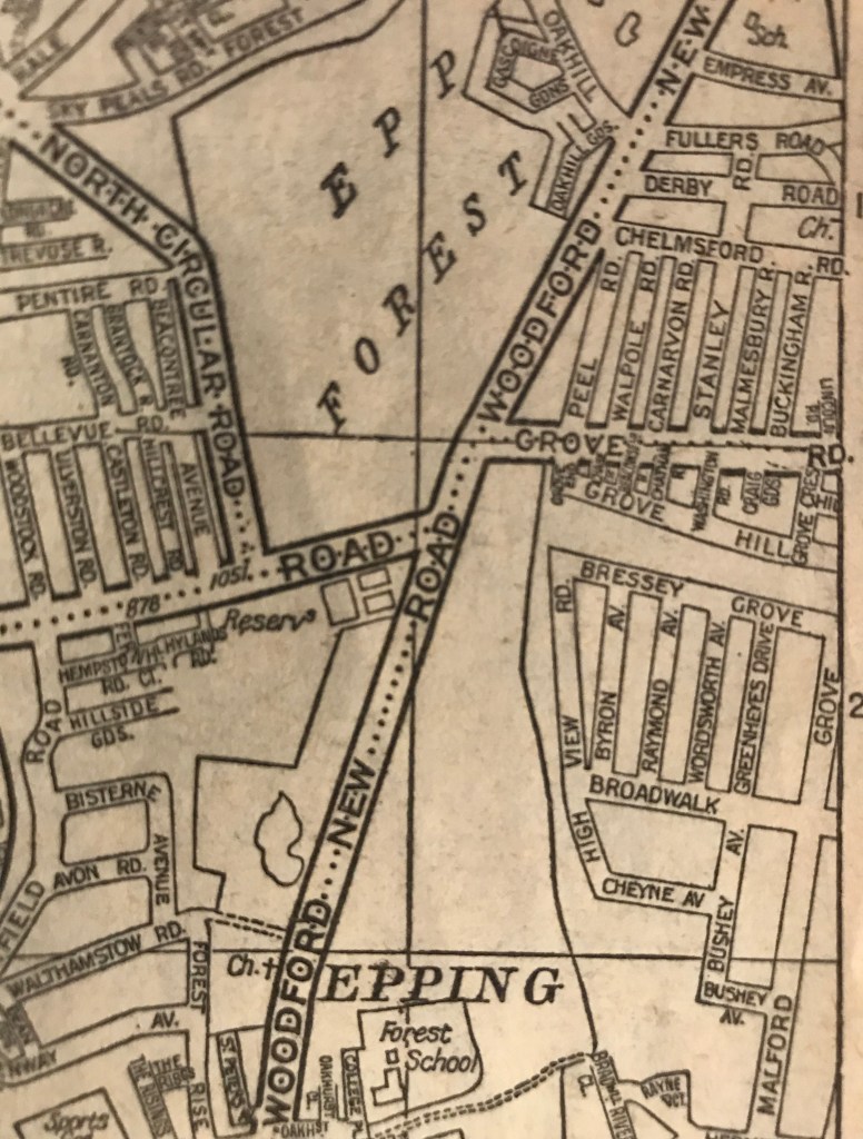
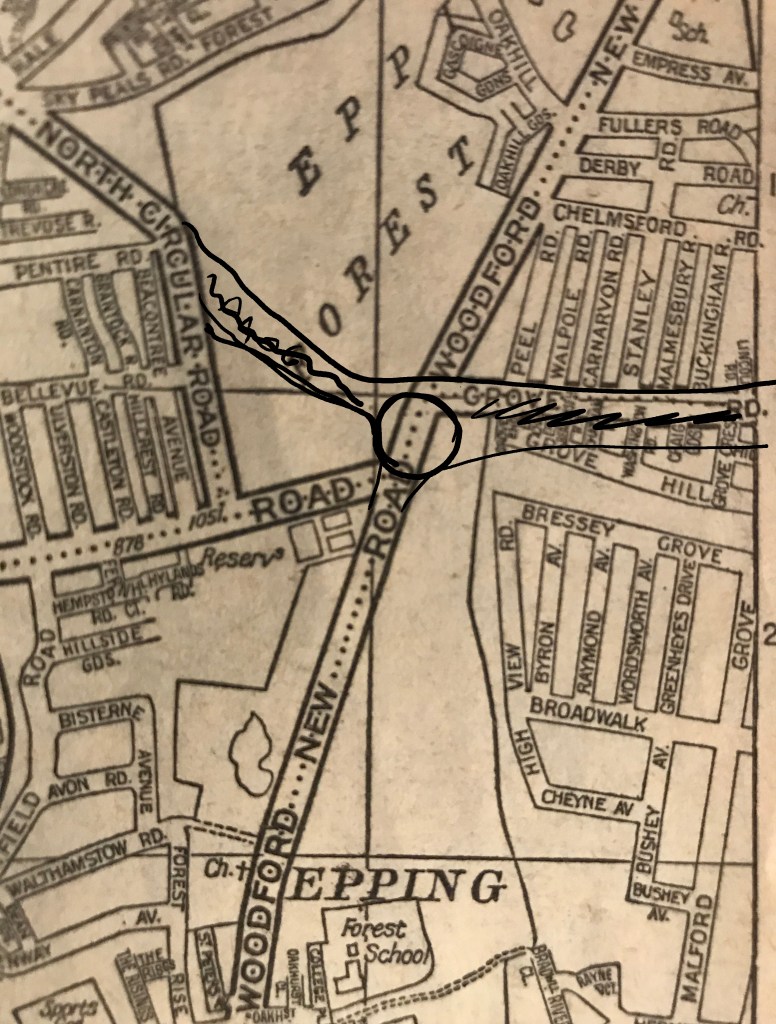
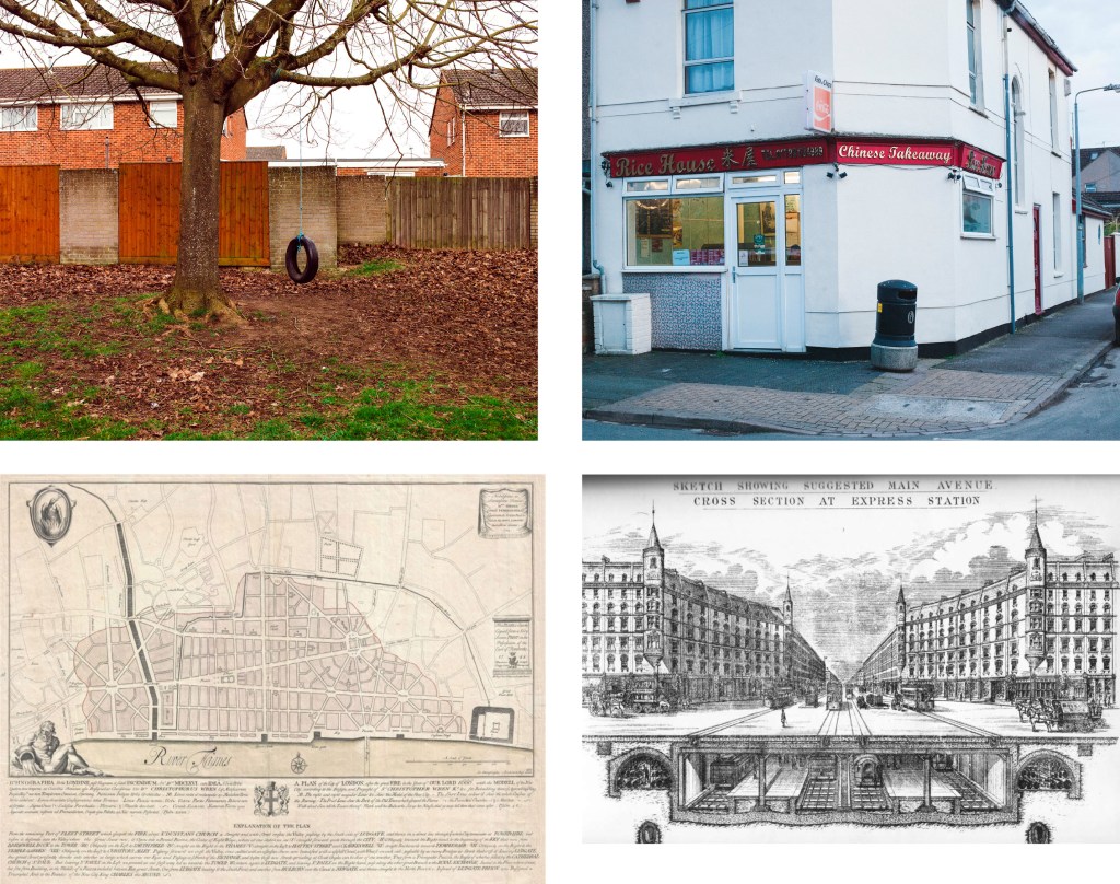
From top left going right clockwise,Recce images for illustration of Grove Hill and A406. Walker Evans Houses,Atlanta Georgia (1936) Detail. Road map of the area before and a rough approximation of the relief road taken from an A-Z of London date unknown a bit dog eared (bottom right)
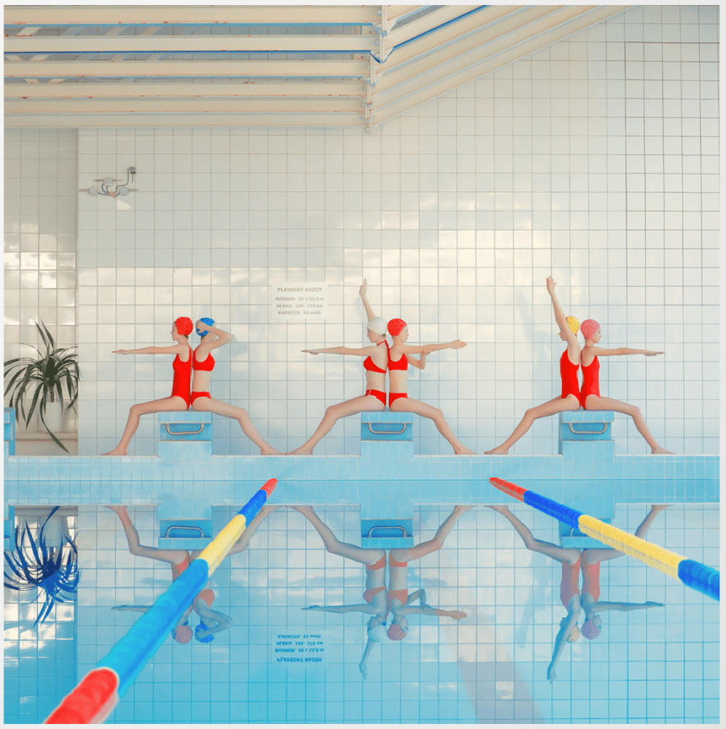
I have caught a glimpse of the work of Maria Svarbova before but for some reason I have not explored further until this week,I highly recommend you take a look at https://www.mariasvarbova.com/ I love the way her commercial work as been able to mimic her personal work so well and goes to prove the point how the close links to personal and commercial work are more important than ever when looking to be commissioned,something we have been discussing as part of this module.
As well as this my particular interest is her exploration of space and how us humans fill it and use it in relation to nature.From an aesthetic point of view I would pick out the the use of repetition via reflections and in some cases in the use of retouching to form and reinforce some of the messages. I like the use of reflections and plan to use something similar.
In relation to my own work in general and in particular my latest project A406 I relate well to the use of very graphic composition,the use of lines separating areas creating several points of interest also in my case the use of shadows in her case reflections help fulfil a sense of calm and quietness to both sets of images.
Left: Maria Svarbova Swimming pool series . Right: Dean Belcher A406 series
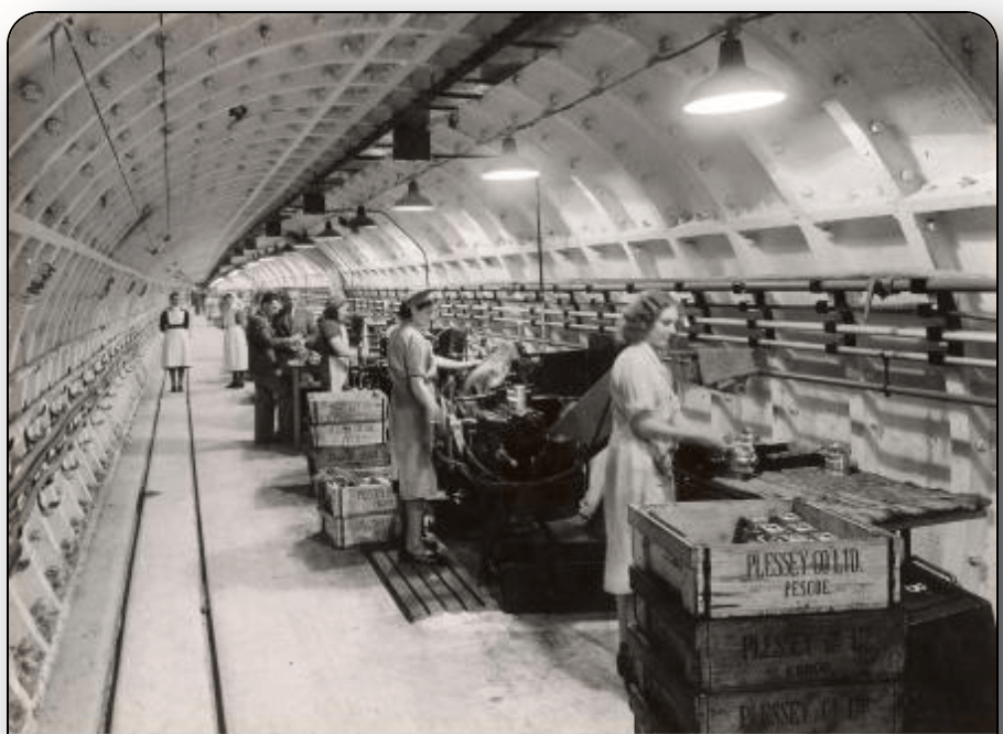
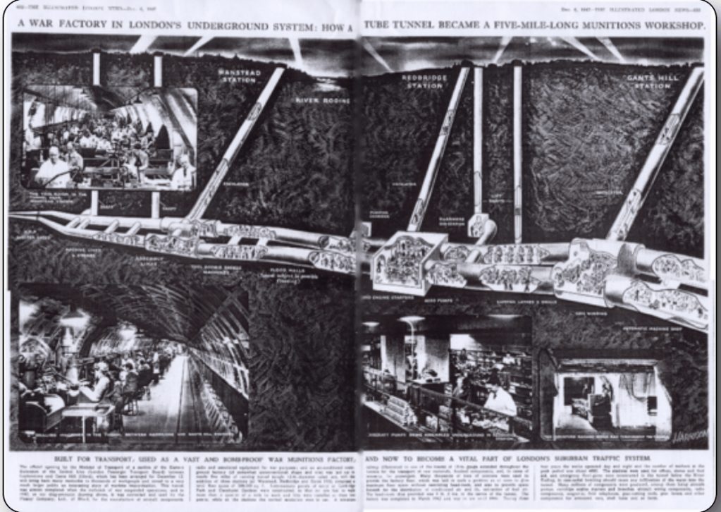
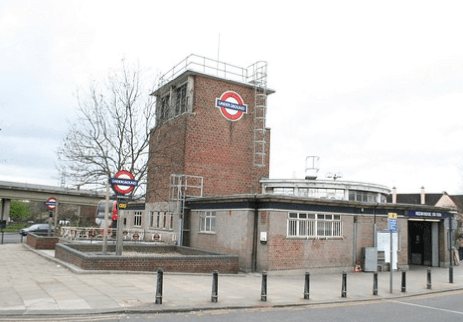
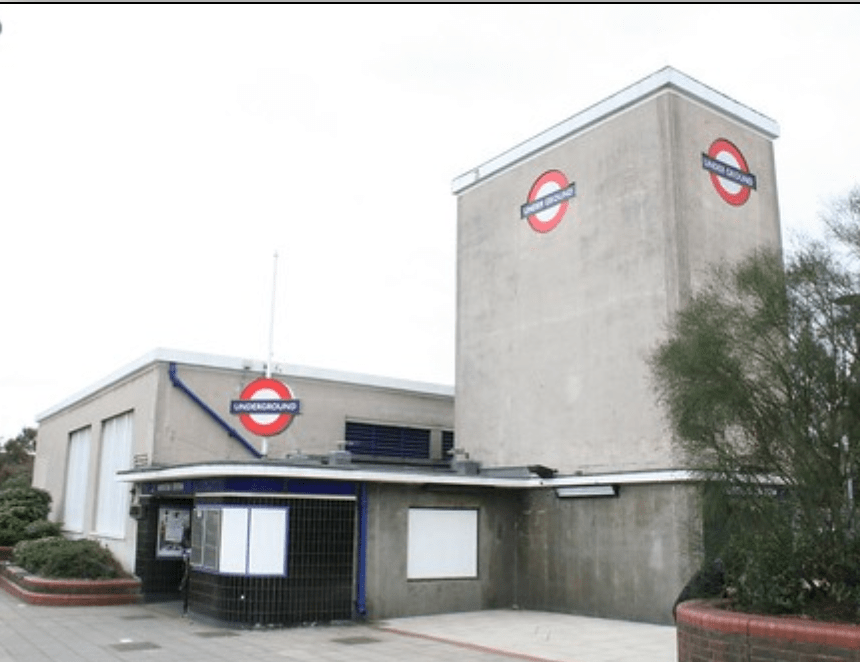
I heard something really interesting on the radio today and partly related to my project.Apparently during the second world war.Plessey who were a big employer in the UK and had a huge factory in Ilford,very close to where the A406 runs today.It was bomb damaged early on in the war and because it was important to the war effort was granted leave to create a factory deep underground in the tunnels that were dug as an extension for the Central line on the London Underground train network,the extension was postponed until the end of the war.
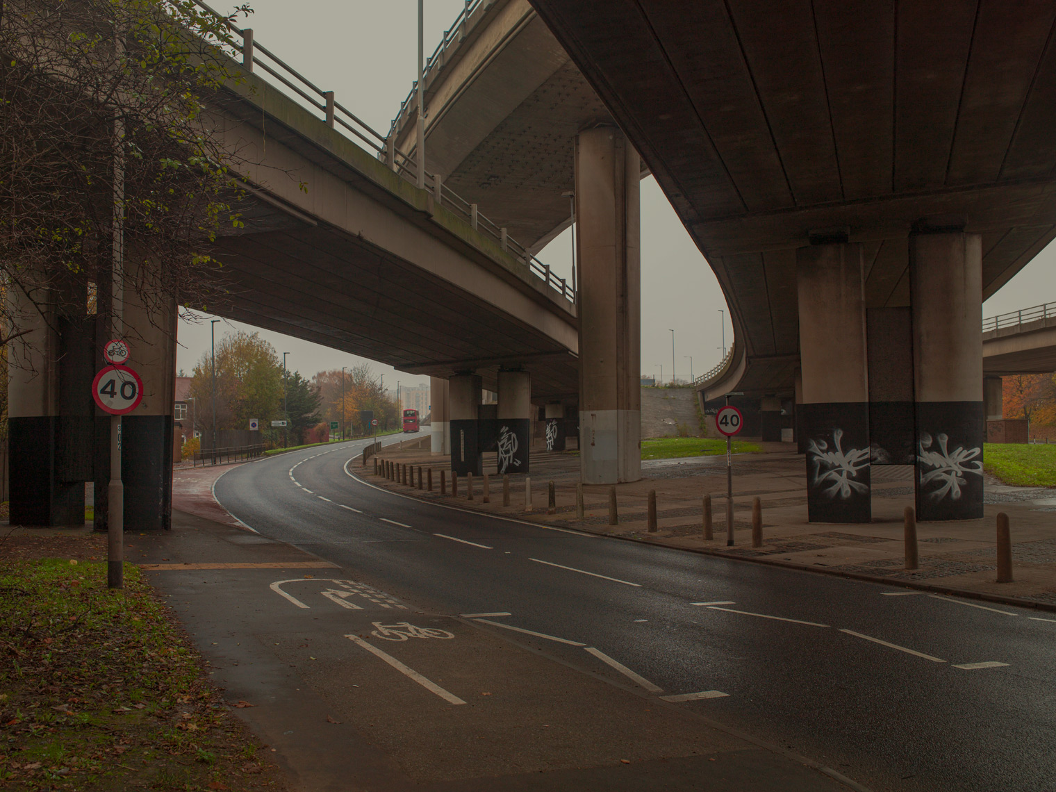
The factory used 3/4 mile of tunnel and the interesting part is that the entrances to the factory were what were to be the underground stations at Gants Hill,Redbridge and Wanstead.There was also several lift and ventilation shafts built along the route,all of which exist to this day.When the A406 flyover was built after the war and Plessey had moved out of the tunnels to make way for the planned extension they tried to knock them down but being tied to a short building schedule and the shafts being made of reinforced concrete they were built around and incorporated into the construction. I’m going to research further,I think it could be interesting and reinforces the historical arguments for keeping essential war work out of the centre of cities,much like the gunpowder mills in Waltham Abbey.
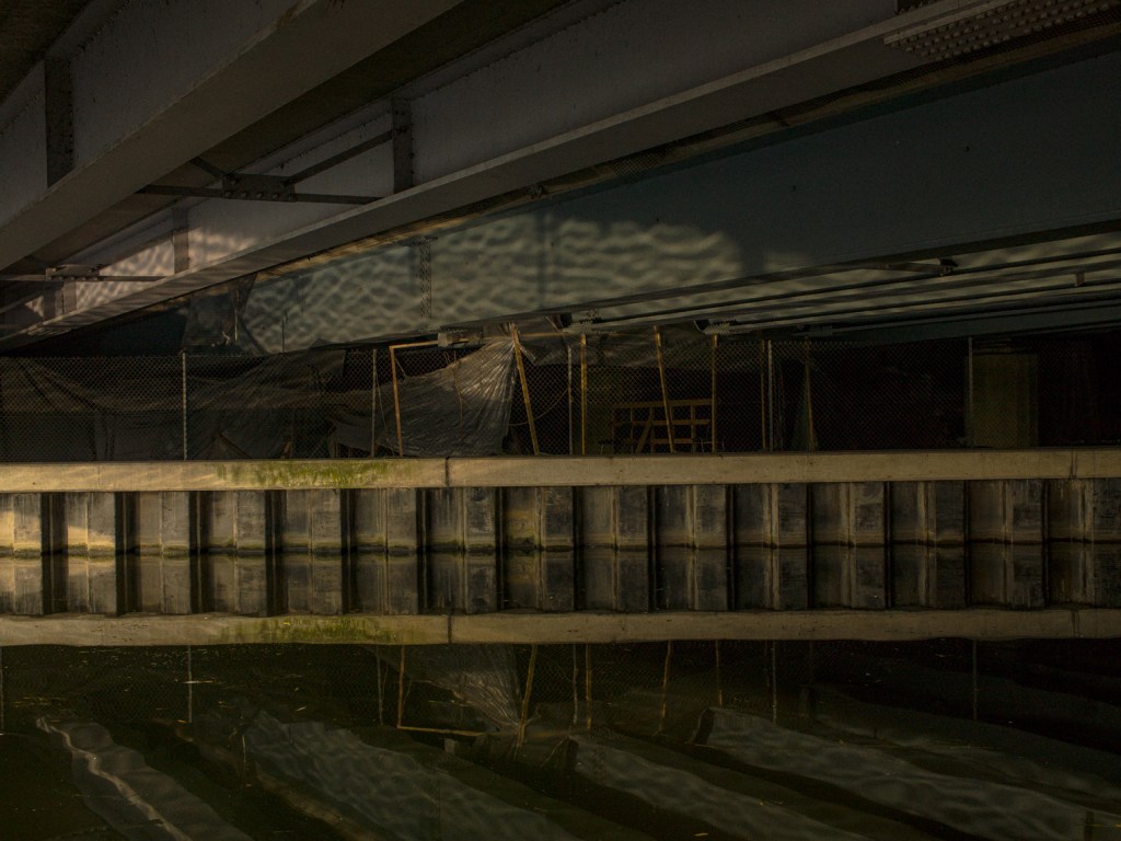
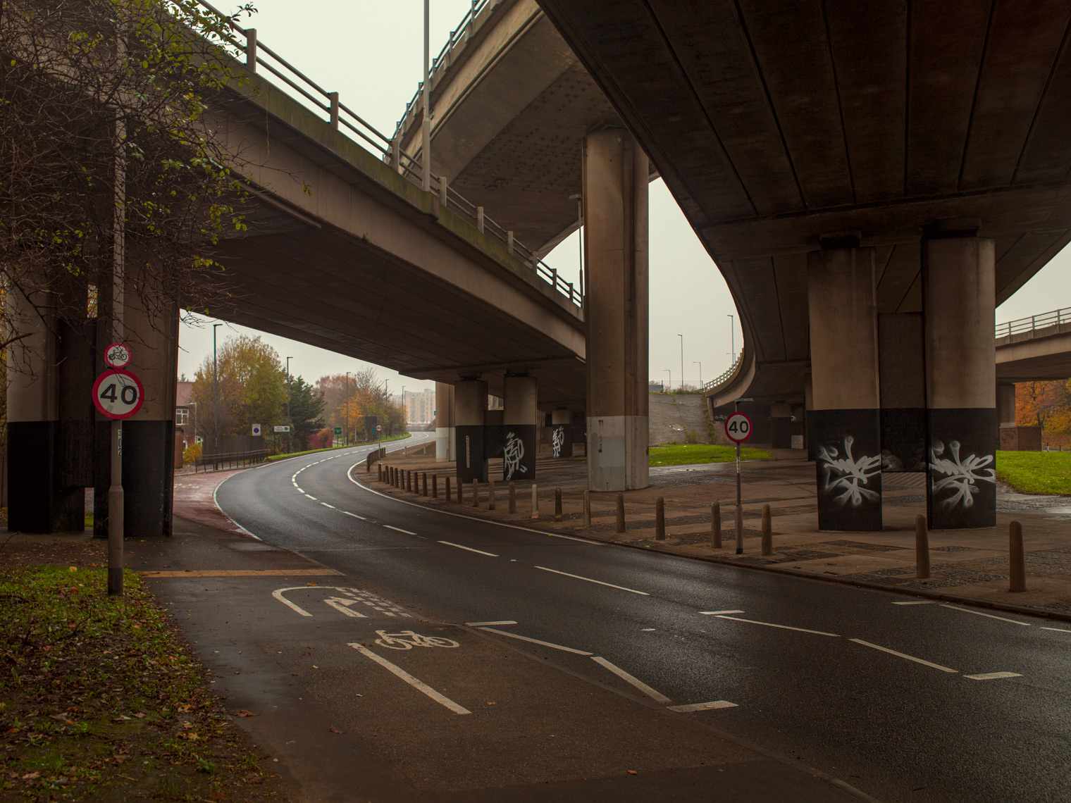
I woke to to a heavy mist and decided one of the images I had in mind to shoot at night might actually suit this weather.I do plan to still shoot it at night and compare the options in the final edit.I was lucky to find another shot too,one I had been hoping to find at some point,it was actually very close by.These three images below explore the architecture of the road and the invasion of space.Similar to the work of Nick St Oegger’s work looking at the M4 extension opened in 1966,his project Bypassed also explores the physical effects of the architecture as well as the economic and environmental and the way that as effected the town of Port Talbot.Much like Nick I want to understand how living so close to the road and in particular where houses and shops and businesses have been demolished to accommodate it alters peoples lives for the positive as well as the negative.The Psychological landscape.
A406 . Dean Belcher
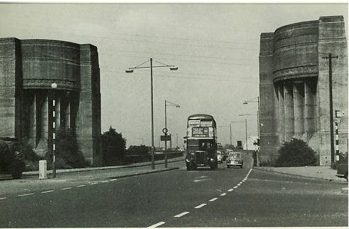
I particularly like the way the pillars mimic the two large entrance pillars on the original Lea valley flyover built in the 1920’s mile or two up the road which were knocked down when the road was widened (Image included) in the mid 1970s.The original flyover was the first of it’s kind to made of reinforced concrete.
Original Lea Valley flyover with pillars 1960s courtesy of Roaders digest
I have travelled this road and seen both ends many times and recently I was considering how much it as been a part of my life.For twenty years I have travelled it to get to my studio or to the big supermarkets,to get to the M4 West to see my folks or maybe the M11 to the airport or on my way to a shoot location,recently instead of using it to take my kids somewhere,swimming lessons,football practice,ballet I’m using it visit my kids houses,soon i’m sure the full circle will happen and i’ll be taking the next generation to swimming lessons,football practice or ballet.
Ongoing of course I plan to photograph and ask other people what their thoughts are.Some of my relations will remember when at least part of it was not there,in fact I can vaguely remember how pleased my dad was with the time saved when they built the Southend Rd extension that runs nearby my house now.I must of been under ten years old but I can still remember when we came off the waterworks junction and went over the cattle grids towards my posh aunts house,those cattle grids are still there and drive over them most days I must record the sound! Before I head on to my point I must just tell you that cows were grazing just next to the road right up until the 1990s and it was not uncommon to find a stray cow in your front garden eating your prize dahlias,there was a few dairies nearby (one of which as only just shut down recently) and back in teh day they kept their own cows up on the common ground then drove them down the main street my street comes off towards the dairy.No kidding and I live in a London postcode….amazing eh!
I digress,that very extension my dad loved so much actually divided a community, where once it gelled nicely from where Epping Forest started there now is a huge 6 lane road.Two whole streets were demolished connected now by two bridges only.I must ask some of the older relatives and people I know what impact it had. Imagine being part of a community looking out across the street a t a row of terrace houses then a couple of years later your front gate is 4 feet from a busy road and you are cut off by this physical barrier from the streets beyond.
At the beginning of this process I spoke with Clare and ran through my proposal it’s changed a little as I expected it to in an organic way much as many projects do,well mine anyway. This is an outline of the first research I did my initial hopes and ambitions for the idea and where I see it heading.
I was looking for a photographic vehicle initially to explore issues such as migration,climate change,town planning,the politics and resultant social consequenses of these.In the present climate it’s interesting to relate these to a historical context and how we relate as humans to it. I chose a road and this one in particular because it offers opportunities to explore many if not all of these things and set them out with a common link visually and metaphorically.I’m keen to explore how the history of this road as effected and formed communities along side it, how it was formed out of economic neccesity.
The rise in rents of the early twentieth century in traditional areas of manufacture closer to the city forced businesses to move to the outskirts coupled with the the advent of motor cars made the transport of goods and communications quicker and easier the expansion of the London really started to take shape.Quickly forming new communities often made up of migrating people both from existing communities (Jewish people for instance to Gants Hill) and more lately new communities seeking work from Eastern europe.
Originally conceived post WW1 it linked these business’s and protected other essential business’s safe during conflict,the road as grown organically linking these areas of business and community from the early 20th century expanding many times through to the present time.The most part being through the work of the town planners during the 1960s as part of the London Ringways scheme,much of which was abandoned but consisted of 4 ringroads one of which the Westaway is pretty much the only bit ever built to feed traffic and rail on a raised road above the central part of the city thus rendering the streets below practically car less, a second road a bit further out that was to follow what is now the North London Rail line through Camden/Kings x. The North Circular was and I suppose is ring road 3 along with the South circular and the M25 conceived in the 1960s and finished in the 1980s is Ring way number 4.
I’m interested like the Thames in the past how these roads have helped form new communities and how the old ones have faired,how like the tributaries of the Thames roads or new tributaries have formed and formed new settlements and old ones been buried and are long gone like those of the old Docklands out by the City Airport a good example of dystopian town planning if ever there was with it’s ghost pubs once awash with people.Coincidently home to one of the best new parks in London,the Thames Barrier park is fantastic on a summers day,if you can get over the smell of the old Beckton Gas works.
I’m keen to understand more about the places of entertainment for example the illegal raves under the flyovers,the banqueting halls,Crazy Golf and Easy hotels placed right by the busiest most polluted road in England.There are burial grounds and Cafes for bikers,which I can understand,it’s origins being before the big road came through,i’m sure it would have some stories to tell.
Then there is the migration,not only the legal natural migration but also teh many tent cities built by the groups of homeless migrant workers under flyovers and waste ground allowing them easy access to the many Wickes stores where they sell their labour by the day much like the dockers and seamen of the Old Thames.
The theory I have heard is they set up around these hostile places because less people pass through such unpleasant places and so are less vulnerable to unwanted attention and attacks.
And what of the future,it looks quite rosy with new estates of housing being built,cross rail stations nearby,legal places to rave ! Using up the brownfield sites laid in waste as flytippers paradises for decades whilst succesive town planners and governments decide what to do with them.The houses compulsary purchased for road widening in the 1980s that have also laid waste gathering dust have been renovated and given a new lease of life. I wonder how the people forcibly moved out all that time ago think about that now.
I hope as part of this project to speak to some of these people and many more and record a oral history to show along side the images.
Along side this multi media exhibition I envisage a book and have Hoxton Mini Press in mind to published based on the local interest subject matter and the publishing model they use.I’m keen to get localised interest through workshops and exhibitions,visits to school and local organisations. Radio interest via Robert Elms London radio show,something I have used before for previous projects.I’d like to work alongside organisations such as RIBA who I am aware exhibit and hope to interest in this body of work.
Here are some of the influences and references I have used to inform the project.As I go on I will be referring back to them and others as I progress and write about the project.
The ice age is coming, the sun is zooming in Meltdown expected, the wheat is growin’ thin Engines stop running, but I have no fear ‘Cause London is drowning, and I, I live by the river . London Calling/The Clash
I don’t as it goes (although anybody living in London is never too far away) but like the rush of the Thames and flow of the water my road,the road at the end of my road the A406 is a constant,even as I type this with my window open I can hear the rush of traffic,only on some days when the wind blows in the right direction is it audible but none the less it’s there,i’ve not paid it much heed in the past but it’s like a ever present being,quiet at times slumbering,quietly humming at others,never a noisy distraction more a gentle quite pleasant,reassuring hum.On occasion in the early hours of the morning I’ve heard powerful cars and motorcycles hurtle round around noisily presumably free from the usual traffic.I must photograph them.
I keep coming back to this idea of it as a modern day version of the river,but instead of a nautical highway around which man from Roman times onwards built a major city over 2 thousand years this is a river of tarmac slithering through neighbourhoods providing for the communities that have built around it who take what they need and pollute like a Victorian version of the Thames.Stretches of the road are amongst the most polluted in the UK.
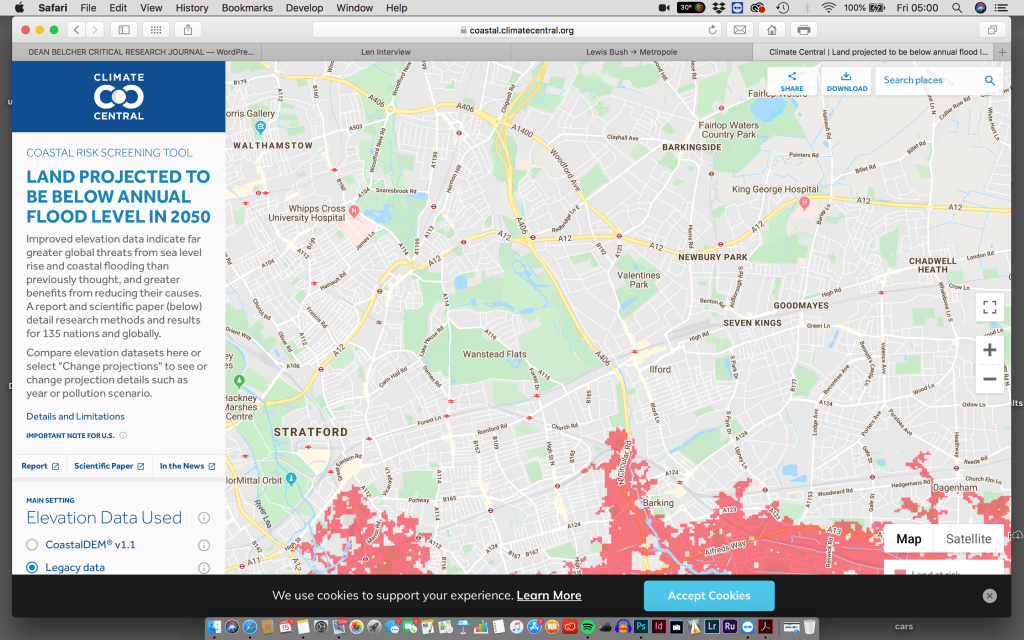
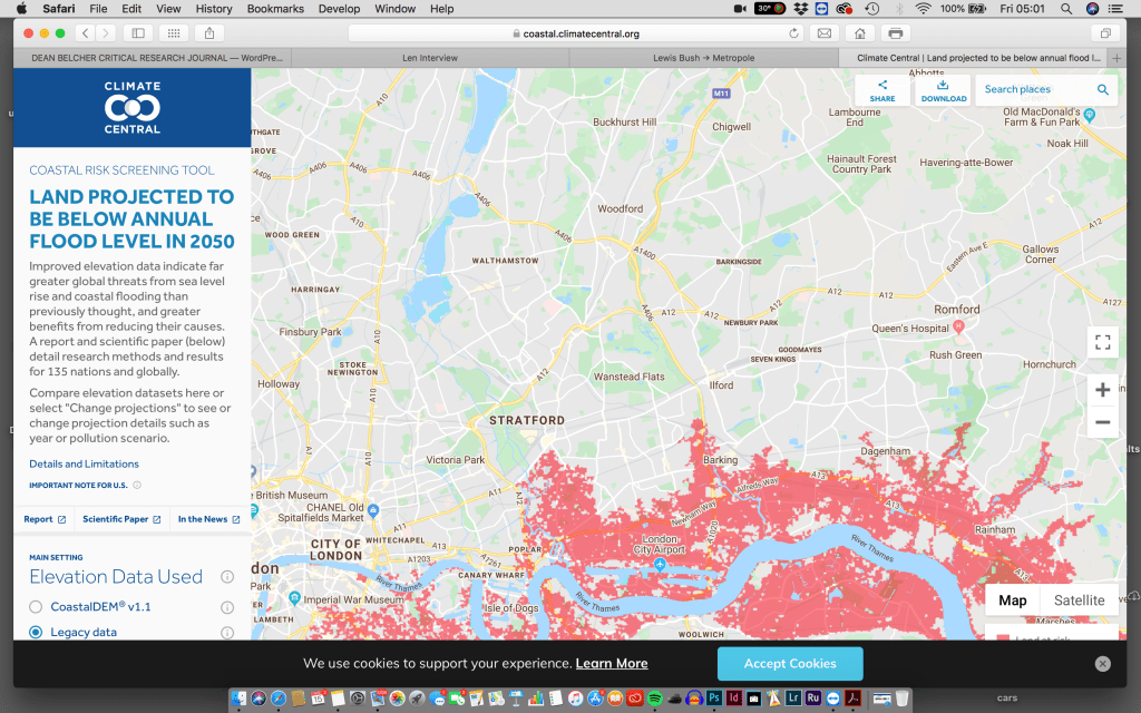
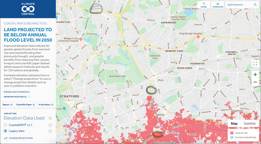
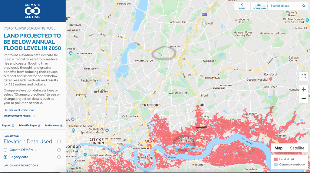
Despite the fact the river flows through the middle of our city the road at no point meets it,ironically though during my research I have found evidence that by 2050 the river may actually come to the road,joining up roughly where the A406 at present ends.Nature taking over and reclaiming where the town planners have failed,if I survive that long I will in fact be living very much closer to the Thames.
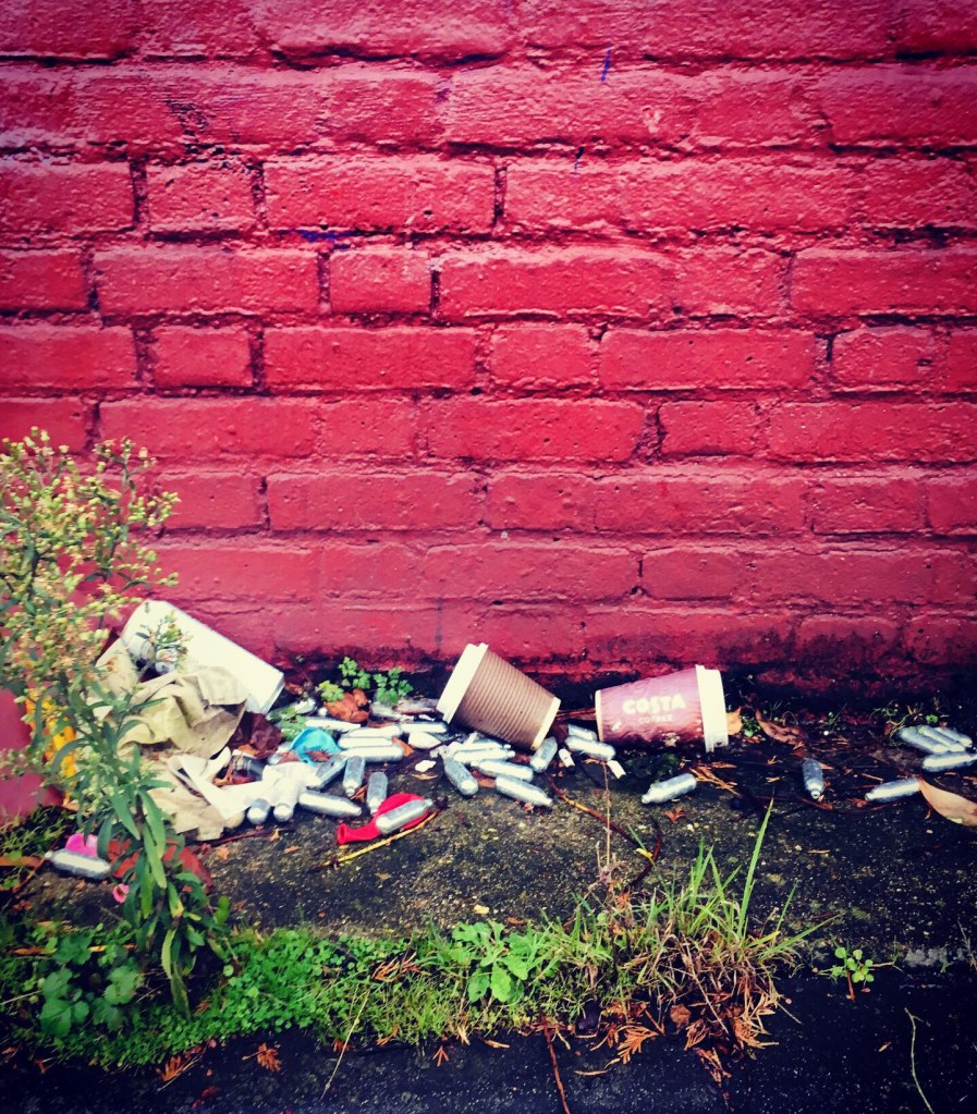
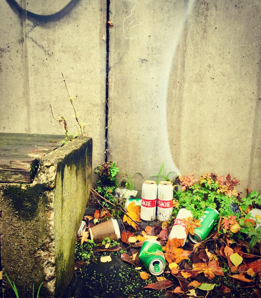
One day on the banks much like the mudlarkers of today they will find the detritus that befalls the roadside,evidence of lorry drivers caught short,old mattresses that have fallen off the van on its way to the dump or flytipping site,odd shoes,cigarette packets and old soda cans,along side the fall out of teenagers who may well have spent many a night drinking cheap beer,sniffing nitrous from balloons whilst discussing the meaning of life or maybe just who they fancy and reciting Grime lyrics into their imaginary microphones,all whilst sat on dilapidated benches that have been placed facing the most boring parts of the road a mere 4 feet away from the rush of traffic.